 #HurricaneIda
 made landfall near Port Fourchon on Sunday as a Category 4 storm with 150 m.p.h. winds, according to the National Hurricane Center.
#Ida, the ninth named storm of the 2021 Atlantic
#hurricane season, formed on Thursday in the Caribbean Sea. The storm is expected to bring eight to 16 inches of
#rain from southeast Louisiana to coastal Mississippi and Alabama through Monday morning.
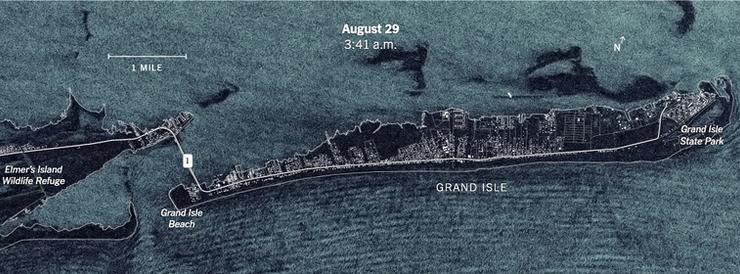
ICEYE Satellites took pictures in the hours before the #storm made landfall showed how much of Grand Isle became submerged as
#heavyrains caused
#flooding in low-lying regions along the Louisiana coast.
source: www.nytimes.com